Case study
cuTunnel
An interactive map of Carleton's underground tunnel network that finds the quickest route between any two buildings.
Wolfram Award and People's Choice, cuHacking 6
The problem
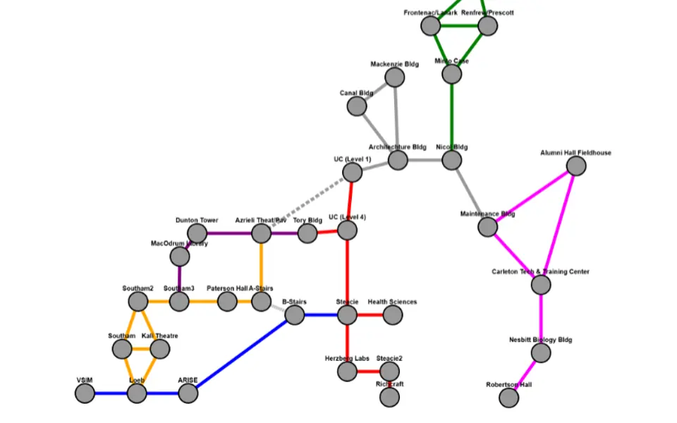
Carleton's buildings connect through a tunnel system that first-years find hard to navigate, and in an Ottawa winter it is the way to get to class on time. cuTunnel lets students and faculty tap a start and a destination and see the shortest route underground, with an estimated walking time.
The approach
- The tunnel network is a hand-built weighted graph: 37 building and landmark nodes placed at fixed coordinates so the layout matches the campus map, and 46 edges whose weights are walking times gathered by pacing the tunnels.
- Cytoscape.js draws the graph in a single-page app and its built-in Dijkstra implementation computes the route. The path is highlighted and the summed weight shown as minutes and seconds.
- Buildings with several entrances or levels are modelled as more than one node, such as the two University Centre levels joined by their own edge, so routes reflect the stairs people actually take.
- Tap the first building to set the start and the second to route; a third tap, or the empty canvas, clears it. Most tunnel segments are colour-coded by section so the map stays readable.
The result
The hardest part was the data, not the algorithm: measuring believable travel times for 46 segments and turning them into weights. cuTunnel won the Wolfram Award (top five) and People's Choice at cuHacking 6.
Built with
JavaScriptDijkstraCytoscape.js
More case studies
- TraceUnsupervised anomaly detection that surfaced a hidden multi-stage attack in 180,800 unlabelled Apache log lines, then handed analysts an investigation console.
- MapleVaultSigned, hash-linked supplier attestations for Canadian defence procurement, with a verifier that computes Canadian content and catches forgery, tampering and replay.
- Land-cover segmentationWildfire-risk screening for British Columbia homes: segmentation models find buildings and vegetation in aerial imagery, and every parcel gets a FireSmart score.
- Agent²Your real estate agent's agent: text a number, take a short call with an AI voice agent, and get a matched listing back by SMS.